Home /
Expert Answers /
Advanced Math /
20-points-the-ice-extent-at-the-north-pole-is-estimated-using-remote-sensing-from-satellites-pa960
(Solved): (20 points) The ice extent at the North Pole is estimated using remote sensing from satellites. ...
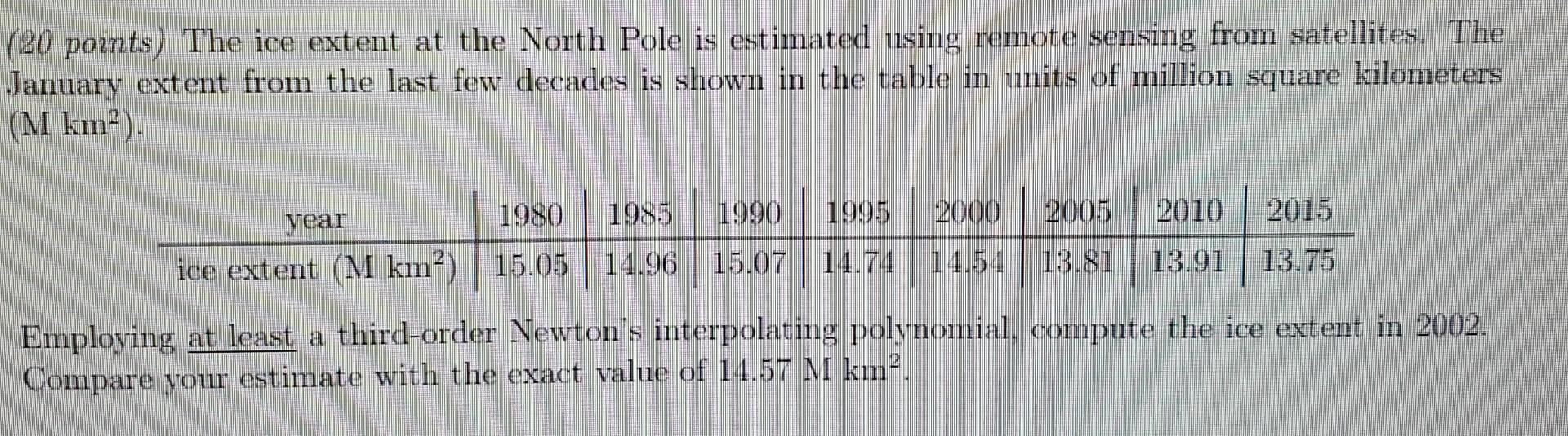
(20 points) The ice extent at the North Pole is estimated using remote sensing from satellites. The January extent from the last few decades is shown in the table in units of million square kilometers . Employing at least a third-order Newton's interpolating polynomial, compute the ice extent in 2002. Compare your estimate with the exact value of .
Expert Answer
To compute the ice extent in 2002 using a third-order Newton's interpolating polynomial, we can use the given data points from the table. Let's denote the year as x and the ice extent as f(x). Given data points are :