Home /
Expert Answers /
Earth Sciences /
questions-3-7-please-3-graphical-scale-bars-are-obviously-used-by-map-readers-to-estimate-distance-pa701
(Solved): Questions 3-7 please. 3. Graphical scale bars are obviously used by map readers to estimate distance ...
Questions 3-7 please.
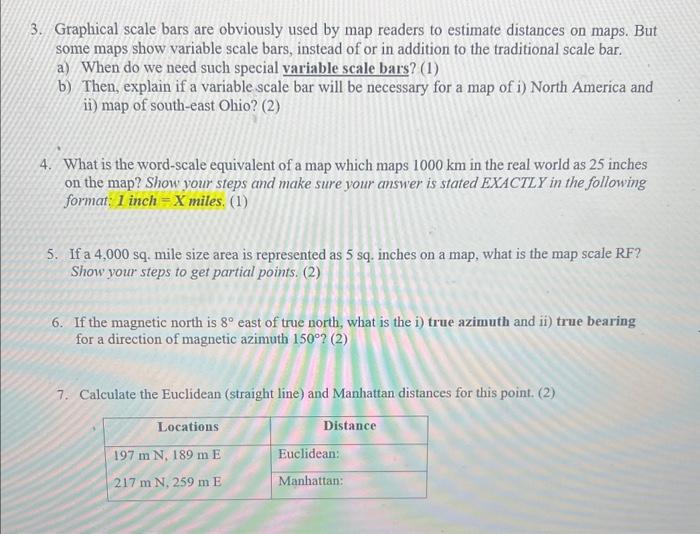
3. Graphical scale bars are obviously used by map readers to estimate distances on maps. But some maps show variable scale bars, instead of or in addition to the traditional scale bar. a) When do we need such special variable scale bars? (1) b) Then, explain if a variable scale bar will be necessary for a map of i) North America and ii) map of south-east Ohio? (2) 4. What is the word-scale equivalent of a map which maps in the real world as 25 inches on the map? Show your steps and make sure your answer is stated EXACTLY in the following format: 1 inch miles. (1) 5. If a 4,000 sq. mile size area is represented as 5 sq. inches on a map, what is the map scale RF? Show your steps to get partial points. (2) 6. If the magnetic north is east of true north, what is the i) true azimuth and ii) true bearing for a direction of magnetic azimuth (2) 7. Calculate the Euclidean (straight line) and Manhattan distances for this point. (2)
Expert Answer
Solution:-7.):-To calculate the Euclide