Home /
Expert Answers /
Earth Sciences /
the-data-points-in-black-on-the-map-represent-surface-elevations-in-feet-the-map-needs-to-be-cont-pa460
(Solved): The data points (in black) on the map represent surface elevations in feet. The map needs to be cont ...
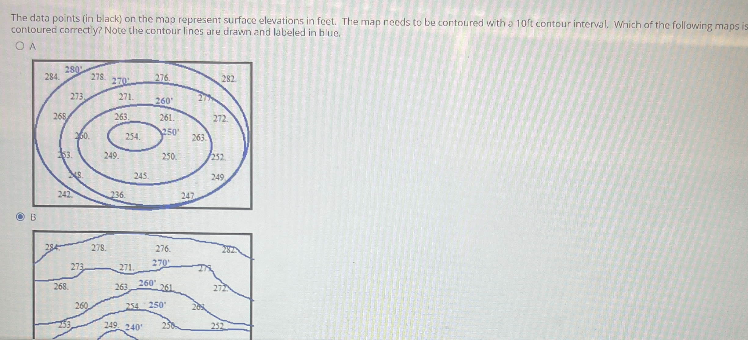
The data points (in black) on the map represent surface elevations in feet. The map needs to be contoured with a 10 ft contour interval. Which of the following maps is contoured correctly? Note the contour lines are drawn and labeled in blue. A B